Aytepe Menekşe Plateau: It is a quality that every healthy person can walk easily, who can take the steep climb for one hour. Menekşe Plateau, which still contains traces of the traditional Eastern Black Sea plateau life, takes its name from the violet flower that adorns the region in spring. Located just north of the plateau, Bayraktepe is 1.073 meters high.
Coordinates: Aytepe – N40 36 02 E29 56 06 955 m Water Station – N40 35 34 E29 55 88 717 m Papaz Çayarı – N40 35 04 E29 54 52 855 m Menekşe Plateau – N40 35 15 E29 54 42 913 m End Aytepe – N40 36 02 E29 56 06 955 m
Aytepe İnönü Plateau: This track, which consists of the full ridge of the Samanlı Mountains and a dirt road in the forest, will be indispensable for hikers in a short time with its easily walkable structure.
Coordinates: Aytepe – N40 35 53 E29 56 31 1012 m Turnoff – N40 34 55 E29 57 15 1077 m Turnoff – N40 34 41 E29 57 09 1114 m Ercuva Plateau – N40 33 39 E29 59 26 1140 m İnönü Plateau – N40 34 30 E30 00 48 1050 m
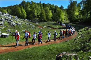
Aytepe – Beşkayalar – Yucacık Dam: Among the natural hiking trails in Kocaeli, perhaps the most well-known is the Aytepe track. In addition to being a track that every healthy person can walk easily, the attractiveness of geography is one of the reasons for preference.
Coordinates: Aytepe – N40 36 02 E29 56 06 955 m Water station – N40 35 34 E29 55 88 717 m Yuvacık Dam – N40 38 38 E29 56 41 200 m
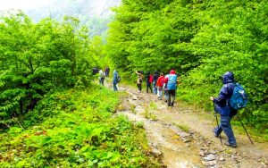
Aytepe – Bıçkıdere – Soğukdere – Aytepe: It is a track where every healthy person will not have any difficulties. On this track, it is possible to see the beginning of Soğukdere Valley from a bird’s eye view. Part of the track passes through the canyon.
Coordinates: Aytepe – N40 35 54 E29 56 31 1010 m Bıçkıdere Turn – N40 34 17 E29 56 04 847 m Water Station – N40 35 34 E29 55 88 717 m Aytepe – N40 36 02 E29 56 06 955 m
Aytepe – Değirmendüzü – Yuvacık Dam: Most of this track, which is visually perfect and has a geography where everyone can walk comfortably, consists of descents. Therefore, it is beneficial to use a cane, especially during the walk.
Coordinates: Aytepe – N40 36 02 E29 56 06 955 m Değirmendüzü Six – N40 37 06 E29 55 34 481 m Yuvacık Dam – N40 38 38 E29 56 41 200 m
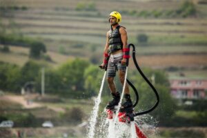
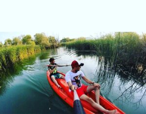
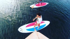
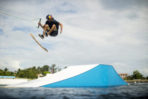
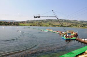
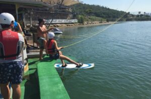
Gölkay- The Northcable Park Water Sports Activities
Gölkay Park, which was built in Bıçkıdere Pond, was built considering all kinds of social needs, from the walking path around the pond to the bicycle path, from the children’s playground to the sports area, from the recreation areas to the viewing amphitheater, from the fishing platforms to the green areas, from the social facility building to the pier.
Gölkay Park, which has the title of being Turkey’s first cabled water ski facility built on a natural pond, aims to open its doors to the whole world as a sports and life center. Gölkay Park contributed to the
promotion of the province by hosting an international youth and sports organization in 2010.
.